
Travel stories unravel uncrossed path let loose to the human world.
 |
| Entrance Point |
 |
| Rules and Regulations for Tourists |
 |
| Satellite View of Gadaikallu and Jamalabad Fort. The grey circle depicts our current location before the climb. |
Eversince my friend recommended a visit to Gadaikal I made plans to visit it sooner than ever. Climbing this granite rock has always been on the top of my to-do list.
 |
| A first glimpse of Gadaikallu |
Basically Gadaikallu is an old hilltop in Killoor road, Belthangady,Dakshina Kannada District, Karnataka, India.It is located in the Kudremukh range of hills,8 km north of Belthangady town and 65 km from the city of Mangalore. It is also referred locally as "Jamalabad" or "Gadaikallu".
This place is easily accessible to the tourist.
At the bottom of the hill one can see boards with info about the hill. Being an aspect of Archeological Survey of India it is protected by rules and regulations. Entry fee is charged at a nominal price for people for who wants to visit this place.
 |
| Entrance Point |
 |
| Break no rules.. 😵😵 |
The climb to the top starts with a steep man made steps . The real climb starts when one encounters granite steps with an inclination height. The shades of the trees offers great resting place for trekkers enroute to the top.
On reaching at a certain height granite steps cut from the rock surfaces . From this point one can have a great view of the adjoining areas of the Charmadi Ghat and areas around it.
If one wants to see clouds and mist here and there ,one should visit this place early morning.
 |
| Mangalore-Bangalore Highway early morning. |
Travel Blog starts from here onwards::
2nd October the date of travelling. Me and my friend (Royce D'Souza) set out to explore this place from MANGALORE. Gadaikal is situated at around 65 km from Mangalore City.
 |
| Approaching Belthangady Town |
We set out at around 5:00 am from Mangalore and reached Belthangady at 6:30am. Had tea with idli vada for breakfast at a shop. Bought 2 litre of water bottle to keep away dehydration mode while climbing atop. Also packed some Puri bhaji for lunch. Remember to bring loads of water,energy drinks,food to chew since the climb is a tiring one and the only shop available is at the base with minimal things available such as water and juices.
 |
| Breakfast at Belthangady Idli vada 😋😋 |
One need to take a left deviation if travelling from Mangalore .One needs to take a left after crossing the Belthangady bridge. From here onwards the way to the foot of the hill is around 6 km approx.
 |
| Welcome gesture from Google Map 🗺 |
On the way a look to the left one can notice a massive granite rock .You guess it correctly.That's Gadaikallu. Yes the one we are about to climb to the summit point. Before reaching the bottom of the hill one comes across a bridge with rivers flowing underneath it.
 |
| Gadaikallu |
After 5 mind from the bridge we reach the foot of the hill. There is a forest check post where we need to enter name and pay a nominal charge few of 20 rupees each. To our luck no one was available at the moment.lucky us.
 |
| Clouds playing hide and seek 🌥🌥 |
 |
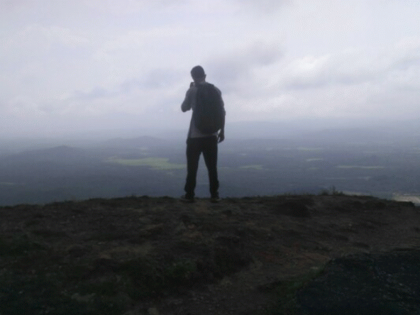
| 💙 The View 🌥🌥 |
We started the climb at around 7:30 am(time noted). The climb atop gives u a glimpse of the Charmadi Ghat section. One can easily sight clouds playing hide and seek with the morning sunrise here and there. After a certain climb we came across an ancient canon left to rust near a way leading to the top of the hill.
One can sight at least 5 canon on the way to the top.
 |
| Canon |
 |
| 1st canon sighted 🔫 |
 |
| Crocs and Canon . C for C .. 😂😂 |
From here onwards the climb to the top is hard a little though. The climb involved climbing a series of a hundred of steps to the top. We encountered a entrance to the fort once we reach the end of the steps.
 |
| Steps leading further more to the top |
 |
| Slippery steps on the way up |
Graffiti of names written on the monument is a sad sight to see on how well people seems to care for our ancient monument.
 |
| Beyond d horizon🎑 |
A further climb to the top leads to an area full of Greenery. One can sight a pond on the left.
 |
| Greens...😃😃 |
A further straight ahead one can see an unmanned microwave repeater station (lay man words: antenna)on top of the hill.From here onwards the way leads to a tower like structure where view of the kudremukh ranges and the Charmadi Ghat section is visible on a clear sky.
This place is good for photograph enthusiast .
 |
| Greenery everywhere. |
 |
| An insect sighted🐛🐛 |
Going further back where the antenna is situated one need to take a left and climb a little further to find a abandoned house. The house might be used for storing ammunition in the olden days. It also serves as a refuge for trekkers during rainy season. From here we can have a 270° degree view of Ujire town and the adjoining areas. The view from here is quite mesmerising.


We stay at the top of the hill for around 1 hour max. Since it was afternoon already the rays of the sun has already been shining so vigorously. Finding a shade to escape the sun rays is minimal here.
 |
| A refuge place ..🌧🏡 |
We made plans to descend back down. Descending is quite risky .Every step taken climbing down is a risk. It took more time to climb down than climbing up since it was drizzling quite a bit on the way down and the stairs here became slippery onwards.
 |
| On the way down |
 |
| Way down 👇⏬ |
On the way down we met the gate keeper . Paid him the ticket charge for 2 which cost 40 rupees.
Climbing Gadaikal will always have a place and memories that I will forever cherish here onwards. Finally we bade goodbye as we move on to Mangalore.
Gadaikal see you untill next time.. 👋👋


